
- Start >
- Groundwater >
- Waterlevel of upper layer >
- Isar >
- UNTERE ISAR SP 62 >
- Chart of total period

Chart of total period UNTERE ISAR SP 62
Groundwater levels of the total period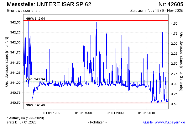
Groundwater level [m above sealevel]: 340.53
Distance to surface [m]: 3.44
Last value from 19.05.2026 08:25
Ground level [m above sealevel]: 343.97
| Date | Groundwater level [m above sealevel] |
|---|---|
| 19.05.2026 | 340.53 |
| 18.05.2026 | 340.52 |
| 17.05.2026 | 340.53 |
| 16.05.2026 | 340.53 |
| 15.05.2026 | 340.52 |
| 14.05.2026 | 340.52 |
| 13.05.2026 | 340.52 |
| 12.05.2026 | 340.52 |
© Bayerisches Landesamt für Umwelt 2026