
- Start >
- Groundwater >
- Waterlevel of upper layer >
- Isar >
- UNTERE ISAR SP 61 >
- Year chart of precipitation

Year chart of precipitation UNTERE ISAR SP 61
Groundwater levels of the last 12 months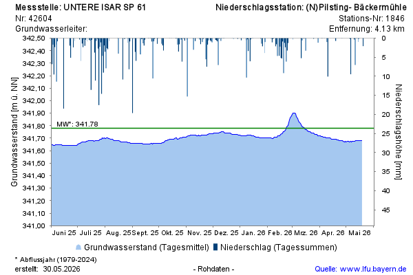
Groundwater level [m above sealevel]: 341,70
Distance to surface [m]: 3,45
Last value from 10.02.2026 09:55
Ground level [m above sealevel]: 345.15
© Bayerisches Landesamt für Umwelt 2026