
Current data UNTERE ISAR SP 60
Groundwater level [m above sealevel]: 342.81
Distance to surface [m]: 2.73
Last value from 19.05.2026 08:05
Ground level [m above sealevel]: 345.54
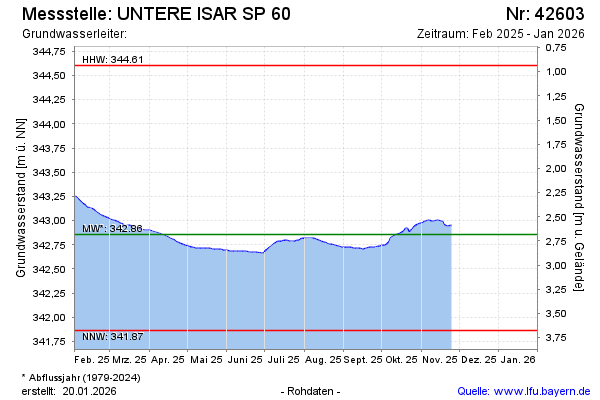
| Date | Groundwater level [m above sealevel] |
|---|---|
| 19.05.2026 | 342.81 |
| 18.05.2026 | 342.81 |
| 17.05.2026 | 342.81 |
| 16.05.2026 | 342.80 |
| 15.05.2026 | 342.80 |
| 14.05.2026 | 342.79 |
| 13.05.2026 | 342.79 |
| 12.05.2026 | 342.79 |