
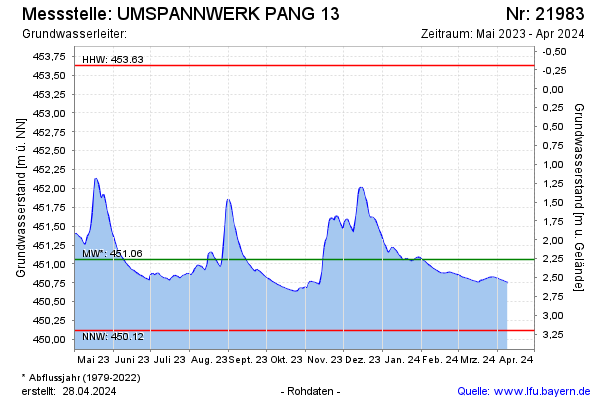
Current data UMSPANNWERK PANG 13
Groundwater level [m above sealevel]: 450,74
Distance to surface [m]: 2,58
Last value from 15.07.2026 11:27
Ground level [m above sealevel]: 453.32
| Date | Groundwater level [m above sealevel] |
|---|---|
| 15.07.2026 | 450.74 |
| 14.07.2026 | 450.73 |
| 13.07.2026 | 450.74 |
| 12.07.2026 | 450.75 |
| 11.07.2026 | 450.76 |
| 10.07.2026 | 450.78 |
| 09.07.2026 | 450.79 |
| 08.07.2026 | 450.80 |