
- Start >
- Groundwater >
- Waterlevel of upper layer >
- Isar >
- UEBERFILZEN 748 >
- Chart of total period

Chart of total period UEBERFILZEN 748
Groundwater levels of the total period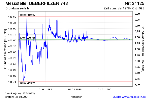
note
Die Messstelle wurde 1996 zurück gebaut.
Groundwater level [m above sealevel]: 457.55
Distance to surface [m]: 1.08
Last value from 18.10.1993 12:00
Ground level [m above sealevel]: 458.63
| Date | Groundwater level [m above sealevel] |
|---|---|
| 17.05.1993 | 457.54 |
| 29.10.1992 | 457.60 |
| 15.06.1992 | 457.53 |
| 29.10.1991 | 457.51 |
| 29.05.1991 | 457.64 |
| 09.10.1990 | 457.59 |
| 15.05.1990 | 457.47 |
| 31.10.1987 | 457.60 |
© Bayerisches Landesamt für Umwelt 2026