
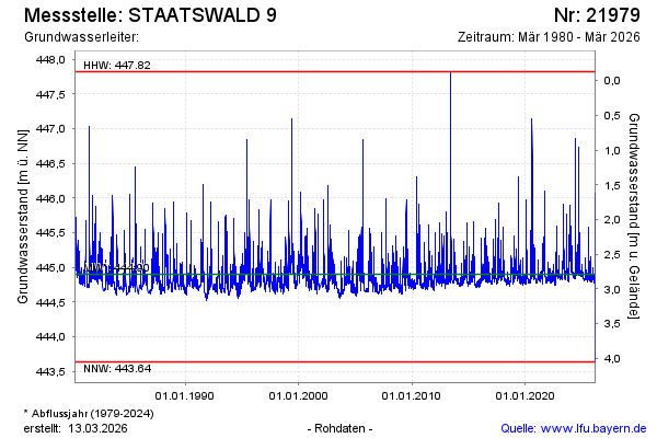
Chart of total period STAATSWALD 9
Groundwater level [m above sealevel]: 444,79
Distance to surface [m]: 2,90
Last value from 15.07.2026 12:20
Ground level [m above sealevel]: 447.69
| Date | Groundwater level [m above sealevel] |
|---|---|
| 15.07.2026 | 444.78 |
| 14.07.2026 | 444.78 |
| 13.07.2026 | 444.78 |
| 12.07.2026 | 444.79 |
| 11.07.2026 | 444.79 |
| 10.07.2026 | 444.80 |
| 09.07.2026 | 444.81 |
| 08.07.2026 | 444.81 |