
Current data Siegsdorf 98
Groundwater level [m above sealevel]: 594.82
Distance to surface [m]: 7.05
Last value from 24.06.2026 09:00
Ground level [m above sealevel]: 601.87
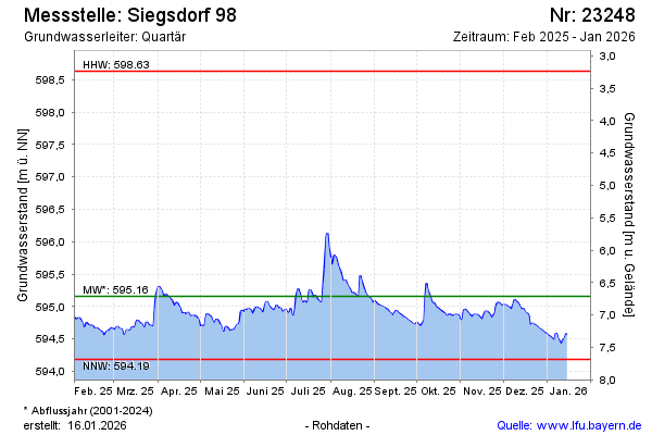
| Date | Groundwater level [m above sealevel] |
|---|---|
| 29.06.2026 | 594.67 |
| 28.06.2026 | 594.61 |
| 27.06.2026 | 594.57 |
| 26.06.2026 | 594.75 |
| 25.06.2026 | 594.77 |
| 24.06.2026 | 594.81 |
| 23.06.2026 | 594.80 |
| 22.06.2026 | 594.82 |