
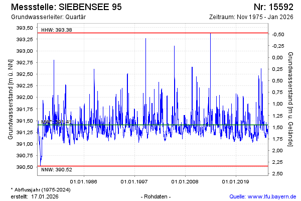
Chart of total period SIEBENSEE 95
Groundwater level [m above sealevel]: 391.09
Distance to surface [m]: 1.77
Last value from 13.07.2026 10:00
Ground level [m above sealevel]: 392.86
| Date | Groundwater level [m above sealevel] |
|---|---|
| 13.07.2026 | 391.09 |
| 12.07.2026 | 391.09 |
| 11.07.2026 | 391.10 |
| 10.07.2026 | 391.10 |
| 09.07.2026 | 391.11 |
| 08.07.2026 | 391.11 |
| 07.07.2026 | 391.11 |
| 06.07.2026 | 391.11 |