
- Start >
- Groundwater >
- Waterlevel of upper layer >
- Isar >
- Schweitenkirchen flach >
- Chart of total period

Chart of total period Schweitenkirchen flach
Groundwater levels of the total period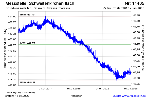
Groundwater level [m above sealevel]: 448.42
Distance to surface [m]: 47.89
Last value from 01.05.2024 10:00
Ground level [m above sealevel]: 496.31
| Date | Groundwater level [m above sealevel] |
|---|---|
| 01.05.2024 | 448.41 |
| 30.04.2024 | 448.35 |
| 29.04.2024 | 448.31 |
| 28.04.2024 | 448.37 |
| 27.04.2024 | 448.41 |
| 26.04.2024 | 448.43 |
| 25.04.2024 | 448.44 |
| 24.04.2024 | 448.43 |
© Bayerisches Landesamt für Umwelt 2024