
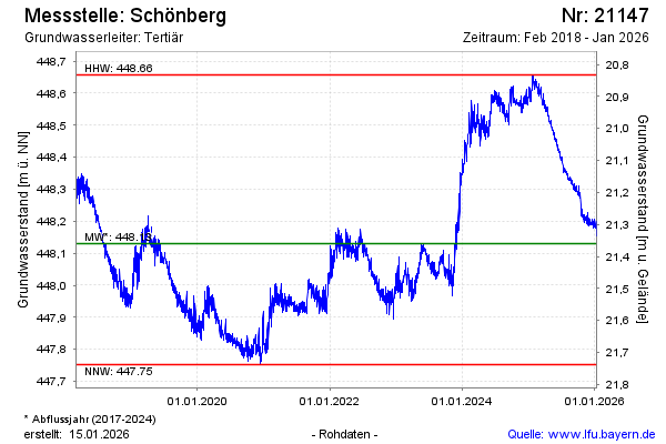
Chart of total period Schönberg
Groundwater level [m above sealevel]: 448,00
Distance to surface [m]: 21,49
Last value from 22.07.2026 09:00
Ground level [m above sealevel]: 469.49
| Date | Groundwater level [m above sealevel] |
|---|---|
| 22.07.2026 | 447.99 |
| 21.07.2026 | 447.99 |
| 20.07.2026 | 447.99 |
| 19.07.2026 | 448.00 |
| 18.07.2026 | 448.01 |
| 17.07.2026 | 448.02 |
| 16.07.2026 | 448.01 |
| 15.07.2026 | 448.00 |