
- Start >
- Groundwater >
- Waterlevel of upper layer >
- Isar >
- SCHLARBHOFEN 16 >
- Chart of total period

Chart of total period SCHLARBHOFEN 16
Groundwater levels of the total period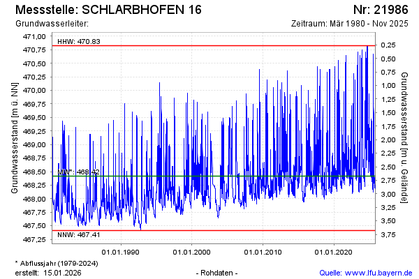
Groundwater level [m above sealevel]: 469.47
Distance to surface [m]: 1.62
Last value from 04.03.2026 10:22
Ground level [m above sealevel]: 471.09
| Date | Groundwater level [m above sealevel] |
|---|---|
| 04.03.2026 | 469.49 |
| 03.03.2026 | 469.55 |
| 02.03.2026 | 469.66 |
| 01.03.2026 | 469.77 |
| 28.02.2026 | 469.87 |
| 27.02.2026 | 470.06 |
| 26.02.2026 | 470.44 |
| 25.02.2026 | 470.70 |
© Bayerisches Landesamt für Umwelt 2026