
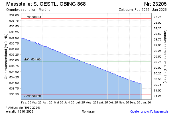
Current data S. OESTL. OBING 868
Groundwater level [m above sealevel]: 533.26
Distance to surface [m]: 31.41
Last value from 13.07.2026 09:00
Ground level [m above sealevel]: 564.67
| Date | Groundwater level [m above sealevel] |
|---|---|
| 13.07.2026 | 533.26 |
| 12.07.2026 | 533.26 |
| 11.07.2026 | 533.26 |
| 10.07.2026 | 533.27 |
| 09.07.2026 | 533.28 |
| 08.07.2026 | 533.28 |
| 07.07.2026 | 533.29 |
| 06.07.2026 | 533.29 |