
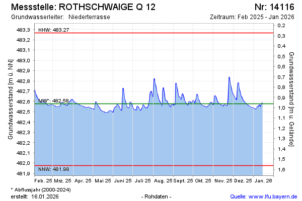
Current data ROTHSCHWAIGE Q 12
Groundwater level [m above sealevel]: 482.45
Distance to surface [m]: 1.09
Last value from 15.07.2026 10:00
Ground level [m above sealevel]: 483.54
| Date | Groundwater level [m above sealevel] |
|---|---|
| 15.07.2026 | 482.45 |
| 14.07.2026 | 482.41 |
| 13.07.2026 | 482.42 |
| 12.07.2026 | 482.42 |
| 11.07.2026 | 482.43 |
| 10.07.2026 | 482.44 |
| 09.07.2026 | 482.45 |
| 08.07.2026 | 482.46 |