
- Start >
- Groundwater >
- Waterlevel of upper layer >
- Isar >
- PUPPLINGER AU 9 >
- Chart of total period

Chart of total period PUPPLINGER AU 9
Groundwater levels of the total period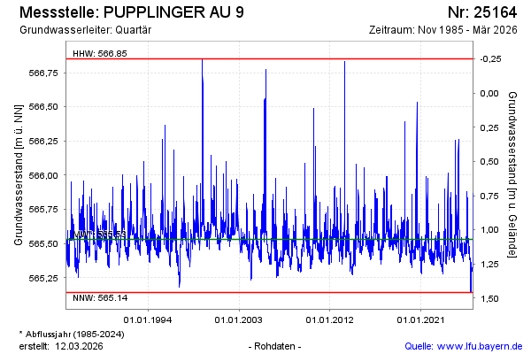
Groundwater level [m above sealevel]: 565.49
Distance to surface [m]: 1.11
Last value from 09.03.2026 02:00
Ground level [m above sealevel]: 566.60
| Date | Groundwater level [m above sealevel] |
|---|---|
| 08.03.2026 | 565.50 |
| 07.03.2026 | 565.52 |
| 06.03.2026 | 565.54 |
| 05.03.2026 | 565.56 |
| 04.03.2026 | 565.59 |
| 03.03.2026 | 565.61 |
| 02.03.2026 | 565.64 |
| 01.03.2026 | 565.68 |
© Bayerisches Landesamt für Umwelt 2026