
- Start >
- Groundwater >
- Waterlevel of upper layer >
- Isar >
- PUCHHEIM 552 >
- Current data

Current data PUCHHEIM 552
Groundwater levels of the last 12 months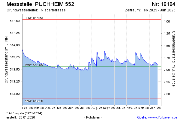
Groundwater level [m above sealevel]: 513.48
Distance to surface [m]: 2.01
Last value from 24.05.2026 10:00
Ground level [m above sealevel]: 515.49
| Date | Groundwater level [m above sealevel] |
|---|---|
| 24.05.2026 | 513.48 |
| 23.05.2026 | 513.48 |
| 22.05.2026 | 513.49 |
| 21.05.2026 | 513.50 |
| 20.05.2026 | 513.52 |
| 19.05.2026 | 513.52 |
| 18.05.2026 | 513.76 |
| 17.05.2026 | 514.02 |
© Bayerisches Landesamt für Umwelt 2026