
- Start >
- Groundwater >
- Waterlevel of upper layer >
- Isar >
- POING D 83 >
- Chart of total period

Chart of total period POING D 83
Groundwater levels of the total period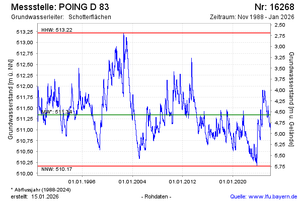
Groundwater level [m above sealevel]: 510.67
Distance to surface [m]: 5.24
Last value from 21.05.2026 10:00
Ground level [m above sealevel]: 515.91
| Date | Groundwater level [m above sealevel] |
|---|---|
| 21.05.2026 | 510.67 |
| 20.05.2026 | 510.67 |
| 19.05.2026 | 510.68 |
| 18.05.2026 | 510.68 |
| 17.05.2026 | 510.69 |
| 16.05.2026 | 510.70 |
| 15.05.2026 | 510.68 |
| 14.05.2026 | 510.67 |
© Bayerisches Landesamt für Umwelt 2026