
- Start >
- Groundwater >
- Waterlevel of upper layer >
- Isar >
- Pietling Nilling 378A >
- Chart of total period

Chart of total period Pietling Nilling 378A
Groundwater levels of the total period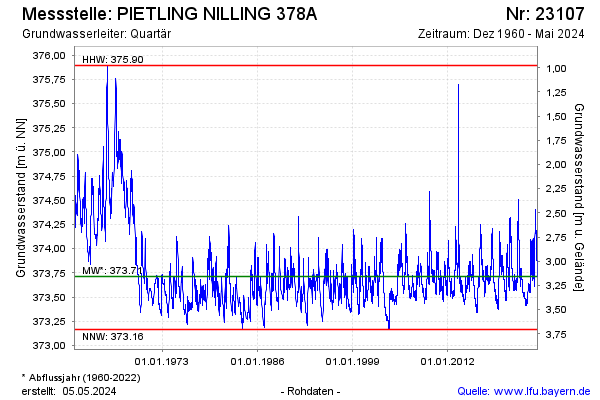
Groundwater level [m above sealevel]: 373.71
Distance to surface [m]: 3.16
Last value from 09.05.2024 09:00
Ground level [m above sealevel]: 376.87
| Date | Groundwater level [m above sealevel] |
|---|---|
| 09.05.2024 | 373.71 |
| 08.05.2024 | 373.70 |
| 07.05.2024 | 373.70 |
| 06.05.2024 | 373.70 |
| 05.05.2024 | 373.70 |
| 04.05.2024 | 373.71 |
| 03.05.2024 | 373.71 |
| 02.05.2024 | 373.71 |
© Bayerisches Landesamt für Umwelt 2024