
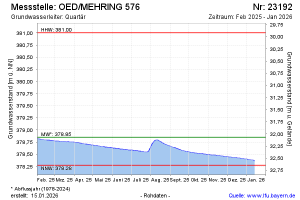
Current data OED/MEHRING 576
Groundwater level [m above sealevel]: 378.28
Distance to surface [m]: 32.64
Last value from 03.07.2026 09:00
Ground level [m above sealevel]: 410.92
| Date | Groundwater level [m above sealevel] |
|---|---|
| 03.07.2026 | 378.28 |
| 02.07.2026 | 378.28 |
| 01.07.2026 | 378.28 |
| 30.06.2026 | 378.28 |
| 29.06.2026 | 378.28 |
| 28.06.2026 | 378.28 |
| 27.06.2026 | 378.28 |
| 26.06.2026 | 378.28 |