
- Start >
- Groundwater >
- Waterlevel of upper layer >
- Isar >
- Oberpoering B 50 >
- Current data

Current data Oberpoering B 50
Groundwater levels of the last 12 months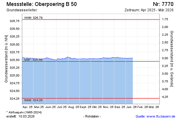
Groundwater level [m above sealevel]: 325.55
Distance to surface [m]: 3.01
Last value from 01.04.2026 13:01
Ground level [m above sealevel]: 328.56
| Date | Groundwater level [m above sealevel] |
|---|---|
| 01.04.2026 | 325.55 |
| 31.03.2026 | 325.55 |
| 30.03.2026 | 325.55 |
| 29.03.2026 | 325.55 |
| 28.03.2026 | 325.55 |
| 27.03.2026 | 325.55 |
| 26.03.2026 | 325.55 |
| 25.03.2026 | 325.55 |
© Bayerisches Landesamt für Umwelt 2026