
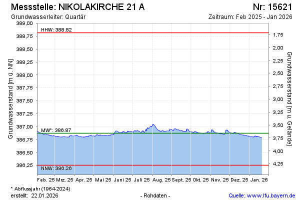
Current data NIKOLAKIRCHE 21A
Groundwater level [m above sealevel]: 386.86
Distance to surface [m]: 3.67
Last value from 06.07.2026 10:00
Ground level [m above sealevel]: 390.53
| Date | Groundwater level [m above sealevel] |
|---|---|
| 06.07.2026 | 386.86 |
| 05.07.2026 | 386.87 |
| 04.07.2026 | 386.88 |
| 03.07.2026 | 386.90 |
| 02.07.2026 | 386.92 |
| 01.07.2026 | 386.88 |
| 30.06.2026 | 386.85 |
| 29.06.2026 | 386.81 |