
- Start >
- Groundwater >
- Waterlevel of upper layer >
- Isar >
- Niederhausen B13 >
- Chart of total period

Chart of total period Niederhausen B13
Groundwater levels of the total period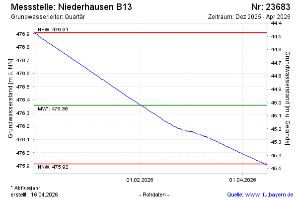
Groundwater level [m above sealevel]: 475.69
Distance to surface [m]: 45.69
Last value from 29.05.2026 09:00
Ground level [m above sealevel]: 521.38
| Date | Groundwater level [m above sealevel] |
|---|---|
| 29.05.2026 | 475.69 |
| 28.05.2026 | 475.69 |
| 27.05.2026 | 475.70 |
| 26.05.2026 | 475.70 |
| 25.05.2026 | 475.71 |
| 24.05.2026 | 475.71 |
| 23.05.2026 | 475.72 |
| 22.05.2026 | 475.72 |
 more data more data | |

© Bayerisches Landesamt für Umwelt 2026