
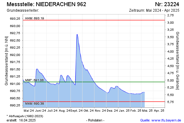
Current data NIEDERACHEN 962
Groundwater level [m above sealevel]: 690.62
Distance to surface [m]: 5.5
Last value from 27.05.2026 08:00
Ground level [m above sealevel]: 696.12
| Date | Groundwater level [m above sealevel] |
|---|---|
| 27.05.2026 | 690.62 |
| 26.05.2026 | 690.62 |
| 25.05.2026 | 690.63 |
| 24.05.2026 | 690.64 |
| 23.05.2026 | 690.65 |
| 22.05.2026 | 690.65 |
| 21.05.2026 | 690.66 |
| 20.05.2026 | 690.67 |