
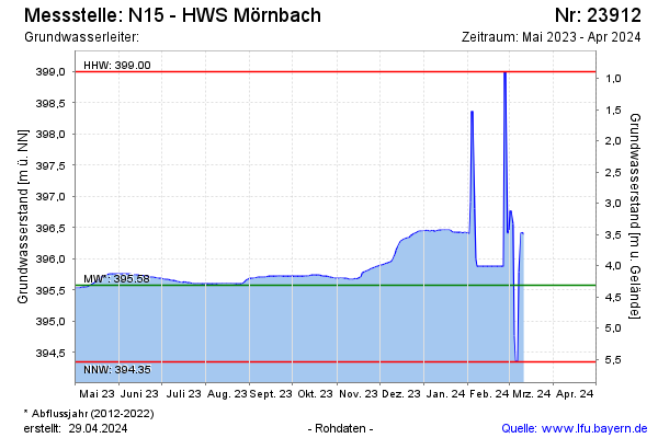
Current data N15 - HWS Mörnbach
Groundwater level [m above sealevel]: 395.51
Distance to surface [m]: 4.34
Last value from 11.03.2026 14:30
Ground level [m above sealevel]: 399.85
| Date | Groundwater level [m above sealevel] |
|---|---|
| 11.03.2026 | 395.51 |
| 10.03.2026 | 395.51 |
| 09.03.2026 | 395.51 |
| 08.03.2026 | 395.52 |
| 07.03.2026 | 395.52 |
| 06.03.2026 | 395.53 |
| 05.03.2026 | 395.53 |
| 04.03.2026 | 395.53 |