
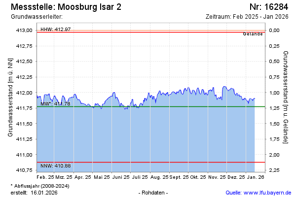
Current data Moosburg Isar 2
Groundwater level [m above sealevel]: 411.62
Distance to surface [m]: 1.38
Last value from 10.07.2026 08:00
Ground level [m above sealevel]: 413.00
| Date | Groundwater level [m above sealevel] |
|---|---|
| 09.07.2026 | 411.54 |
| 08.07.2026 | 411.52 |
| 07.07.2026 | 411.68 |
| 06.07.2026 | 411.85 |
| 05.07.2026 | 411.79 |
| 04.07.2026 | 411.84 |
| 03.07.2026 | 411.89 |
| 02.07.2026 | 411.96 |