
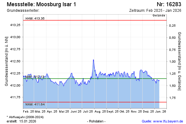
Current data Moosburg Isar 1
Groundwater level [m above sealevel]: 411.98
Distance to surface [m]: 1.51
Last value from 12.07.2026 08:00
Ground level [m above sealevel]: 413.49
| Date | Groundwater level [m above sealevel] |
|---|---|
| 12.07.2026 | 411.98 |
| 11.07.2026 | 411.97 |
| 10.07.2026 | 411.87 |
| 09.07.2026 | 411.83 |
| 08.07.2026 | 411.83 |
| 07.07.2026 | 411.93 |
| 06.07.2026 | 412.04 |
| 05.07.2026 | 411.99 |