
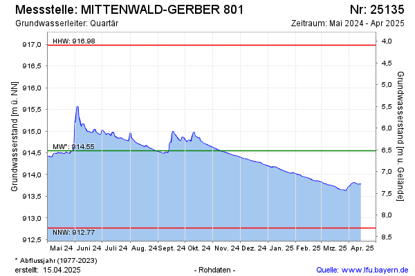
Current data MITTENWALD-GERBER 801
Groundwater level [m above sealevel]: 914.20
Distance to surface [m]: 6.87
Last value from 24.06.2026 12:00
Ground level [m above sealevel]: 921.07
| Date | Groundwater level [m above sealevel] |
|---|---|
| 29.06.2026 | 914.17 |
| 28.06.2026 | 914.17 |
| 27.06.2026 | 914.17 |
| 26.06.2026 | 914.19 |
| 25.06.2026 | 914.20 |
| 24.06.2026 | 914.20 |
| 23.06.2026 | 914.21 |
| 22.06.2026 | 914.22 |