
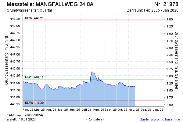
Current data MANGFALLWEG 24 8A
Groundwater level [m above sealevel]: 445.95
Distance to surface [m]: 3.28
Last value from 05.05.2026 11:27
Ground level [m above sealevel]: 449.23
| Date | Groundwater level [m above sealevel] |
|---|---|
| 05.05.2026 | 445.94 |
| 04.05.2026 | 445.94 |
| 03.05.2026 | 445.94 |
| 02.05.2026 | 445.94 |
| 01.05.2026 | 445.94 |
| 30.04.2026 | 445.95 |
| 29.04.2026 | 445.95 |
| 28.04.2026 | 445.96 |