
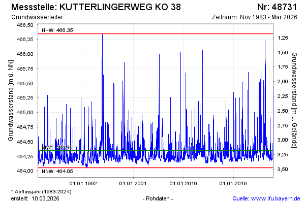
Chart of total period KUTTERLINGERWEG KO 38
Groundwater level [m above sealevel]: 464.19
Distance to surface [m]: 3.34
Last value from 06.05.2026 09:54
Ground level [m above sealevel]: 467.53
| Date | Groundwater level [m above sealevel] |
|---|---|
| 06.05.2026 | 464.18 |
| 05.05.2026 | 464.18 |
| 04.05.2026 | 464.18 |
| 03.05.2026 | 464.18 |
| 02.05.2026 | 464.19 |
| 01.05.2026 | 464.19 |
| 30.04.2026 | 464.19 |
| 29.04.2026 | 464.19 |