
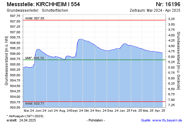
Current data KIRCHHEIM I 554
Groundwater level [m above sealevel]: 504.95
Distance to surface [m]: 5.91
Last value from 06.07.2026 09:00
Ground level [m above sealevel]: 510.86
| Date | Groundwater level [m above sealevel] |
|---|---|
| 06.07.2026 | 504.94 |
| 05.07.2026 | 504.93 |
| 04.07.2026 | 504.92 |
| 03.07.2026 | 504.92 |
| 02.07.2026 | 504.93 |
| 01.07.2026 | 504.90 |
| 30.06.2026 | 504.87 |
| 29.06.2026 | 504.88 |