
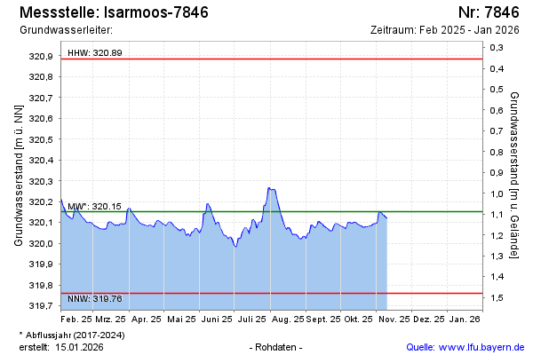
Current data Isarmoos-7846
Groundwater level [m above sealevel]: 320.12
Distance to surface [m]: 1.12
Last value from 02.04.2026 12:24
Ground level [m above sealevel]: 321.24
| Date | Groundwater level [m above sealevel] |
|---|---|
| 02.04.2026 | 320.12 |
| 01.04.2026 | 320.13 |
| 31.03.2026 | 320.13 |
| 30.03.2026 | 320.13 |
| 29.03.2026 | 320.13 |
| 28.03.2026 | 320.13 |
| 27.03.2026 | 320.13 |
| 26.03.2026 | 320.14 |