
- Start >
- Groundwater >
- Waterlevel of upper layer >
- Isar >
- ISAR-KM 22,500 LP 2 >
- Current data

Current data ISAR-KM 22,500 LP 2
Groundwater levels of the last 12 months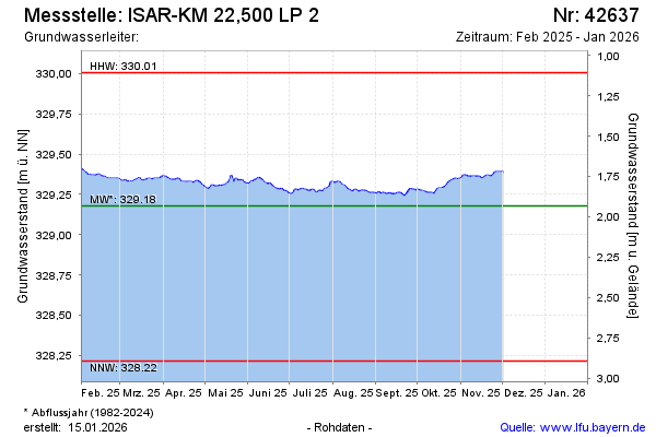
Groundwater level [m above sealevel]: 329.47
Distance to surface [m]: 1.64
Last value from 23.02.2026 10:30
Ground level [m above sealevel]: 331.11
| Date | Groundwater level [m above sealevel] |
|---|---|
| 23.02.2026 | 329.47 |
| 22.02.2026 | 329.46 |
| 21.02.2026 | 329.45 |
| 20.02.2026 | 329.44 |
| 19.02.2026 | 329.44 |
| 18.02.2026 | 329.44 |
| 17.02.2026 | 329.42 |
| 16.02.2026 | 329.40 |
© Bayerisches Landesamt für Umwelt 2026