
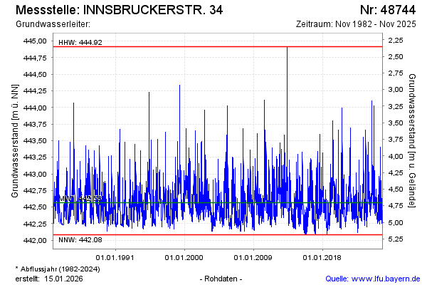
Chart of total period INNSBRUCKERSTR. 34
Groundwater level [m above sealevel]: 442,44
Distance to surface [m]: 4,83
Last value from 17.06.2026 11:54
Ground level [m above sealevel]: 447.27
| Date | Groundwater level [m above sealevel] |
|---|---|
| 17.06.2026 | 442.45 |
| 16.06.2026 | 442.47 |
| 15.06.2026 | 442.51 |
| 14.06.2026 | 442.56 |
| 13.06.2026 | 442.59 |
| 12.06.2026 | 442.63 |
| 11.06.2026 | 442.76 |
| 10.06.2026 | 442.47 |