
- Start >
- Groundwater >
- Waterlevel of upper layer >
- Isar >
- InfraServ W-TBY >
- Chart of total period

Chart of total period InfraServ W-TBY
Groundwater levels of the total period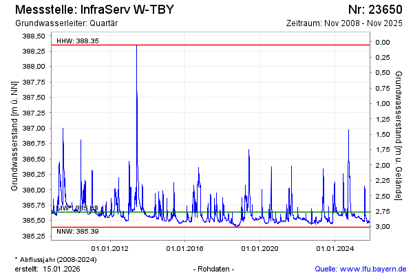
Groundwater level [m above sealevel]: 385.59
Distance to surface [m]: 2.81
Last value from 12.03.2024 11:00
Ground level [m above sealevel]: 388.40
| Date | Groundwater level [m above sealevel] |
|---|---|
| 12.03.2024 | 385.59 |
| 11.03.2024 | 385.59 |
| 10.03.2024 | 385.59 |
| 09.03.2024 | 385.59 |
| 08.03.2024 | 385.59 |
| 07.03.2024 | 385.59 |
| 06.03.2024 | 385.60 |
| 05.03.2024 | 385.60 |
© Bayerisches Landesamt für Umwelt 2024