
- Start >
- Groundwater >
- Waterlevel of upper layer >
- Isar >
- HOHENLINDEN 307 >
- Chart of total period

Chart of total period HOHENLINDEN 307
Groundwater levels of the total period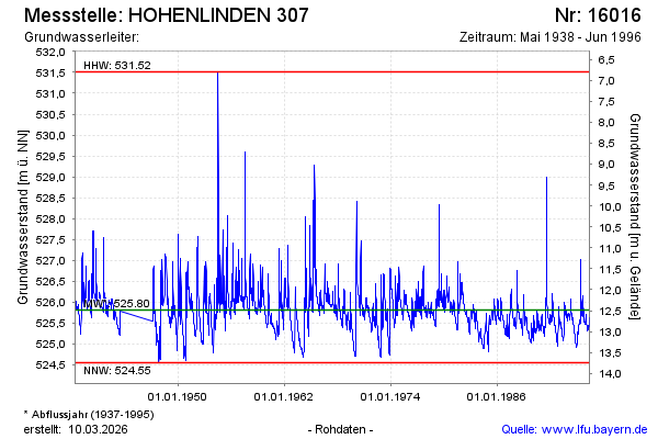
note
Die Messstelle wurde 1996 verfuellt !
Groundwater level [m above sealevel]: 525.52
Distance to surface [m]: 12.78
Last value from 30.06.1996 12:00
Ground level [m above sealevel]: 538.30
| Date | Groundwater level [m above sealevel] |
|---|---|
| 23.06.1996 | 525.54 |
| 16.06.1996 | 525.63 |
| 09.06.1996 | 525.61 |
| 02.06.1996 | 525.50 |
| 26.05.1996 | 525.42 |
| 19.05.1996 | 525.38 |
| 12.05.1996 | 525.35 |
| 05.05.1996 | 525.36 |
© Bayerisches Landesamt für Umwelt 2026