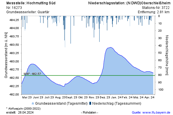
Year chart of precipitation Hochmutting Süd
Groundwater level [m above sealevel]: 482,06
Distance to surface [m]: 9,09
Last value from 22.07.2026 10:00
Ground level [m above sealevel]: 491.15

Groundwater level [m above sealevel]: 482,06
Distance to surface [m]: 9,09
Last value from 22.07.2026 10:00
Ground level [m above sealevel]: 491.15