
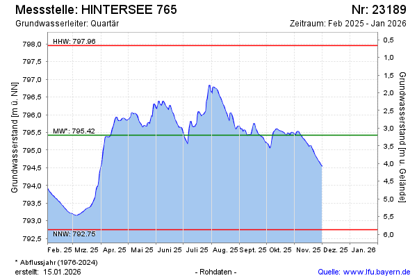
Current data HINTERSEE 765
Groundwater level [m above sealevel]: 795.70
Distance to surface [m]: 2.92
Last value from 05.05.2026 10:35
Ground level [m above sealevel]: 798.62
| Date | Groundwater level [m above sealevel] |
|---|---|
| 05.05.2026 | 795.69 |
| 04.05.2026 | 795.67 |
| 03.05.2026 | 795.64 |
| 02.05.2026 | 795.64 |
| 01.05.2026 | 795.68 |
| 30.04.2026 | 795.73 |
| 29.04.2026 | 795.73 |
| 28.04.2026 | 795.73 |