
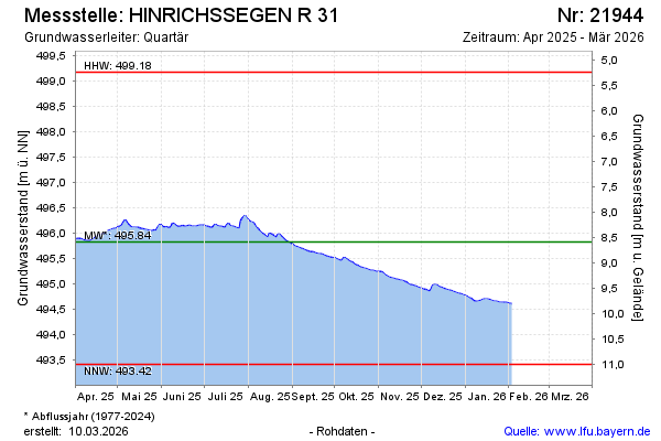
Current data HINRICHSSEGEN R 31
Groundwater level [m above sealevel]: 496.07
Distance to surface [m]: 8.35
Last value from 22.06.2026 08:34
Ground level [m above sealevel]: 504.42
| Date | Groundwater level [m above sealevel] |
|---|---|
| 22.06.2026 | 496.07 |
| 21.06.2026 | 496.08 |
| 20.06.2026 | 496.09 |
| 19.06.2026 | 496.09 |
| 18.06.2026 | 496.09 |
| 17.06.2026 | 496.10 |
| 16.06.2026 | 496.13 |
| 15.06.2026 | 496.15 |