
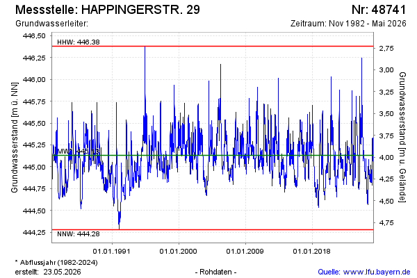
Chart of total period HAPPINGERSTR. 29
Groundwater level [m above sealevel]: 444.84
Distance to surface [m]: 4.27
Last value from 17.06.2026 14:30
Ground level [m above sealevel]: 449.11
| Date | Groundwater level [m above sealevel] |
|---|---|
| 17.06.2026 | 444.83 |
| 16.06.2026 | 444.84 |
| 15.06.2026 | 444.85 |
| 14.06.2026 | 444.86 |
| 13.06.2026 | 444.86 |
| 12.06.2026 | 444.85 |
| 11.06.2026 | 444.84 |
| 10.06.2026 | 444.80 |