
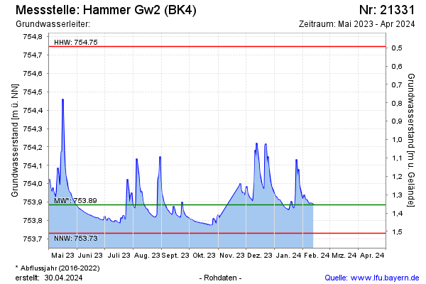
Current data Hammer Gw2 (BK4)
Groundwater level [m above sealevel]: 753.83
Distance to surface [m]: 1.41
Last value from 16.06.2026 12:21
Ground level [m above sealevel]: 755.24
| Date | Groundwater level [m above sealevel] |
|---|---|
| 16.06.2026 | 753.80 |
| 15.06.2026 | 753.81 |
| 14.06.2026 | 753.83 |
| 13.06.2026 | 753.85 |
| 12.06.2026 | 753.83 |
| 11.06.2026 | 753.86 |
| 10.06.2026 | 753.83 |
| 09.06.2026 | 753.78 |