
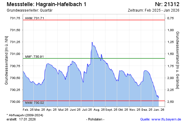
Current data Hagrain-Hafelbach 1
Groundwater level [m above sealevel]: 730.42
Distance to surface [m]: 2.08
Last value from 13.07.2026 07:00
Ground level [m above sealevel]: 732.50
| Date | Groundwater level [m above sealevel] |
|---|---|
| 13.07.2026 | 730.42 |
| 12.07.2026 | 730.45 |
| 11.07.2026 | 730.48 |
| 10.07.2026 | 730.51 |
| 09.07.2026 | 730.54 |
| 08.07.2026 | 730.56 |
| 07.07.2026 | 730.58 |
| 06.07.2026 | 730.58 |