
- Start >
- Groundwater >
- Waterlevel of upper layer >
- Isar >
- Haar-Eglfing Q 11 >
- Current data

Current data Haar-Eglfing Q 11
Groundwater levels of the last 12 months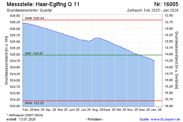
Groundwater level [m above sealevel]: 523.90
Distance to surface [m]: 15.11
Last value from 28.05.2026 10:00
Ground level [m above sealevel]: 539.01
| Date | Groundwater level [m above sealevel] |
|---|---|
| 28.05.2026 | 523.90 |
| 27.05.2026 | 523.91 |
| 26.05.2026 | 523.92 |
| 25.05.2026 | 523.93 |
| 24.05.2026 | 523.94 |
| 23.05.2026 | 523.94 |
| 22.05.2026 | 523.95 |
| 21.05.2026 | 523.96 |
 more data more data | |

© Bayerisches Landesamt für Umwelt 2026