
- Start >
- Groundwater >
- Waterlevel of upper layer >
- Isar >
- GWM Kehrham-Ost >
- Chart of total period

Chart of total period GWM Kehrham-Ost
Groundwater levels of the total period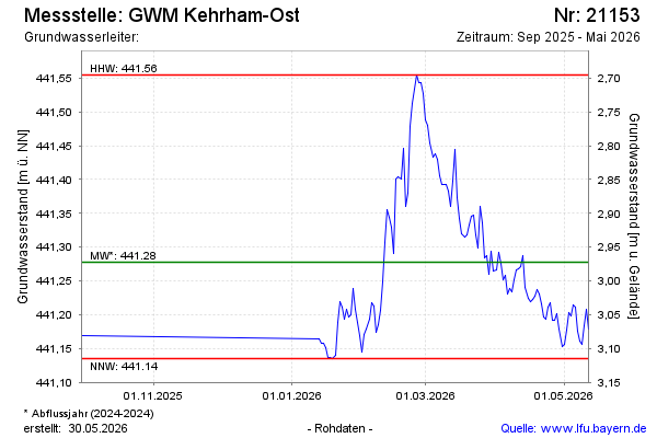
Groundwater level [m above sealevel]: 441.16
Distance to surface [m]: 3.09
Last value from 12.05.2026 11:01
Ground level [m above sealevel]: 444.25
| Date | Groundwater level [m above sealevel] |
|---|---|
| 12.05.2026 | 441.18 |
| 11.05.2026 | 441.21 |
| 10.05.2026 | 441.18 |
| 09.05.2026 | 441.16 |
| 08.05.2026 | 441.16 |
| 07.05.2026 | 441.18 |
| 06.05.2026 | 441.21 |
| 05.05.2026 | 441.21 |
 more data more data | |

© Bayerisches Landesamt für Umwelt 2026