
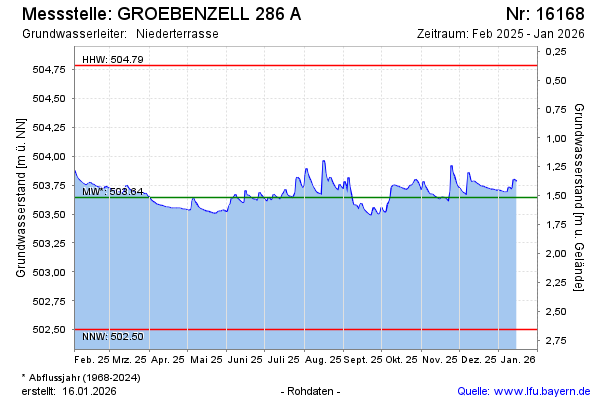
Current data GROEBENZELL 286 A
Groundwater level [m above sealevel]: 503.42
Distance to surface [m]: 1.74
Last value from 07.07.2026 06:00
Ground level [m above sealevel]: 505.16
| Date | Groundwater level [m above sealevel] |
|---|---|
| 06.07.2026 | 503.44 |
| 05.07.2026 | 503.40 |
| 04.07.2026 | 503.40 |
| 03.07.2026 | 503.43 |
| 02.07.2026 | 503.47 |
| 01.07.2026 | 503.44 |
| 30.06.2026 | 503.36 |
| 29.06.2026 | 503.37 |