
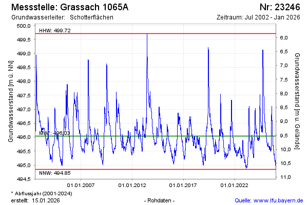
Chart of total period Grassach 1065A
Groundwater level [m above sealevel]: 494,79
Distance to surface [m]: 10,78
Last value from 22.07.2026 09:00
Ground level [m above sealevel]: 505.57
| Date | Groundwater level [m above sealevel] |
|---|---|
| 22.07.2026 | 494.80 |
| 21.07.2026 | 494.80 |
| 20.07.2026 | 494.82 |
| 19.07.2026 | 494.81 |
| 18.07.2026 | 494.81 |
| 17.07.2026 | 494.82 |
| 16.07.2026 | 494.83 |
| 15.07.2026 | 494.84 |