
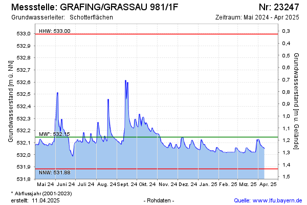
Current data GRAFING/GRASSAU 981/1F
Groundwater level [m above sealevel]: 532.02
Distance to surface [m]: 1.3000000000001
Last value from 13.07.2026 09:00
Ground level [m above sealevel]: 533.32
| Date | Groundwater level [m above sealevel] |
|---|---|
| 13.07.2026 | 532.02 |
| 12.07.2026 | 532.02 |
| 11.07.2026 | 532.03 |
| 10.07.2026 | 532.03 |
| 09.07.2026 | 532.04 |
| 08.07.2026 | 532.04 |
| 07.07.2026 | 532.05 |
| 06.07.2026 | 532.05 |