
- Start >
- Groundwater >
- Waterlevel of upper layer >
- Isar >
- GERETSRIED 177 >
- Chart of total period

Chart of total period GERETSRIED 177
Groundwater levels of the total period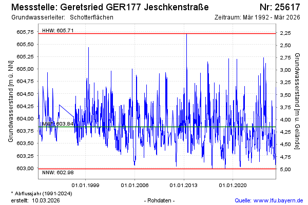
Groundwater level [m above sealevel]: 603.31
Distance to surface [m]: 4.67
Last value from 08.05.2026 02:00
Ground level [m above sealevel]: 607.98
| Date | Groundwater level [m above sealevel] |
|---|---|
| 07.05.2026 | 603.31 |
| 06.05.2026 | 603.31 |
| 05.05.2026 | 603.31 |
| 04.05.2026 | 603.33 |
| 03.05.2026 | 603.34 |
| 02.05.2026 | 603.36 |
| 01.05.2026 | 603.37 |
| 30.04.2026 | 603.39 |
© Bayerisches Landesamt für Umwelt 2026