
- Start >
- Groundwater >
- Waterlevel of upper layer >
- Isar >
- Garmisch-Burgrain D/1K >
- Chart of total period

Chart of total period Garmisch-Burgrain D/1K
Groundwater levels of the total period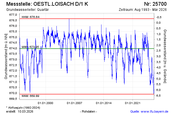
Groundwater level [m above sealevel]: 672.03
Distance to surface [m]: 4.25
Last value from 13.04.2026 02:00
Ground level [m above sealevel]: 676.28
| Date | Groundwater level [m above sealevel] |
|---|---|
| 12.04.2026 | 672.04 |
| 11.04.2026 | 672.03 |
| 10.04.2026 | 672.03 |
| 09.04.2026 | 672.05 |
| 08.04.2026 | 672.06 |
| 07.04.2026 | 672.02 |
| 06.04.2026 | 671.84 |
| 05.04.2026 | 671.52 |
© Bayerisches Landesamt für Umwelt 2026