
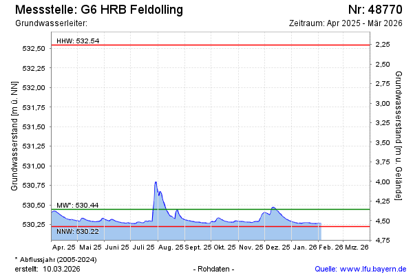
Current data G6 HRB Feldolling
Groundwater level [m above sealevel]: 530.27
Distance to surface [m]: 4.53
Last value from 06.05.2026 13:00
Ground level [m above sealevel]: 534.80
| Date | Groundwater level [m above sealevel] |
|---|---|
| 06.05.2026 | 530.27 |
| 05.05.2026 | 530.27 |
| 04.05.2026 | 530.27 |
| 03.05.2026 | 530.27 |
| 02.05.2026 | 530.27 |
| 01.05.2026 | 530.27 |
| 30.04.2026 | 530.28 |
| 29.04.2026 | 530.28 |