
Current data G18 HRB Feldolling
Groundwater level [m above sealevel]: 520.54
Distance to surface [m]: 9.5500000000001
Last value from 18.11.2025 10:00
Ground level [m above sealevel]: 530.09
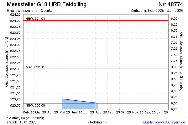
| Date | Groundwater level [m above sealevel] |
|---|---|
| 07.08.2025 | 520.58 |
| 09.05.2025 | 520.76 |
| 19.01.2022 | 523.25 |
| 01.01.2022 | -- |
| 31.12.2021 | -- |
| 30.12.2021 | -- |
| 29.12.2021 | -- |
| 28.12.2021 | -- |