
- Start >
- Groundwater >
- Waterlevel of upper layer >
- Isar >
- FUERSTAETTER-SCHULE 1 >
- Year chart of precipitation

Year chart of precipitation FUERSTAETTER-SCHULE 1
Groundwater levels of the last 12 months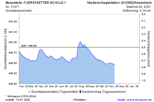
Groundwater level [m above sealevel]: 446,57
Distance to surface [m]: 3,96
Last value from 05.05.2026 11:49
Ground level [m above sealevel]: 450.53
© Bayerisches Landesamt für Umwelt 2026